#AustinSidewalkProject Update: November 2022

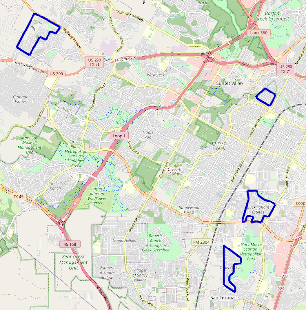
ASP Overview The project expanded into and completed several neighborhoods around South Austin over the course of November. Some of the furthest west neighborhoods in the project's scope were completed in Oak Hill, and the sidewalks of several neighborhoods down Slaughter Lane were mapped in full. OpenStreetMap view of South-Southwest Austin. Neighborhoods mapped in November 2022 in blue. Southwest Oak Hill The Covered Bridge and Enclave at Covered Bridge sidewalks were completed, pushing the project further down TX-71 and reaching the western edge of Austin city limits. Most of Covered Bridge and all of Enclave at Covered Bridge have sidewalks on both sides of their streets, relatively uncommon in the area. All crosswalks in Enclave at Covered Bridge are marked, which is quite rare in Southwest Austin. OpenStreetMap view of Covered Bridge and Enclave at Covered Bridge. Austin city limits in orange, Covered Bridge neighborhoods boundary in blue. The Covered Bridge neighborhoods are...